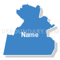
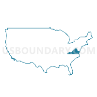
Southside Planning District Commission & Commonwealth Regional Council PUMA, Virginia
About
Outline

Summary
| Unique Area Identifier | 194314 |
| Name | Southside Planning District Commission & Commonwealth Regional Council PUMA |
| State | Virginia |
| Area (square miles) | 4,899.86 |
| Land Area (square miles) | 4,813.19 |
| Water Area (square miles) | 86.67 |
| % of Land Area | 98.23 |
| % of Water Area | 1.77 |
| Latitude of the Internal Point | 37.03335530 |
| Longtitude of the Internal Point | -78.40554360 |
Maps
Graphs
Select a template below for downloading or customizing gragh for Southside Planning District Commission & Commonwealth Regional Council PUMA, Virginia


Neighbors
Neighoring Public Use Microdata Area (by Name) Neighboring Public Use Microdata Area on the Map
- Chesterfield County (West)--Brandermill & Woodlake PUMA, VA
- Crater Planning District Commission PUMA, VA
- Franklin, Vance & Warren (West) Counties PUMA, NC
- Granville, Person & Caswell Counties PUMA, NC
- Halifax, Hertford, Northampton & Warren (East) Counties PUMA, NC
- Hanover, Powhatan, Goochland, New Kent, King William & Charles City Counties PUMA, VA
- Thomas Jefferson Planning District Commission (South & East) PUMA, VA
- Virginia's Region 2000 (North)--Bedford, Amherst, Appomattox Counties & Bedford City PUMA, VA
- Virginia's Region 2000 (South)--Campbell County & Lynchburg City PUMA, VA
- West Piedmont Planning District Commission PUMA, VA
Top 10 Neighboring County (by Population) Neighboring County on the Map
- Chesterfield County, VA (316,236)
- Albemarle County, VA (98,970)
- Pittsylvania County, VA (63,506)
- Granville County, NC (59,916)
- Campbell County, VA (54,842)
- Vance County, NC (45,422)
- Person County, NC (39,464)
- Halifax County, VA (36,241)
- Mecklenburg County, VA (32,727)
- Powhatan County, VA (28,046)
Top 10 Neighboring County Subdivision (by Population) Neighboring County Subdivision on the Map
- Matoaca district, Chesterfield County, VA (74,985)
- Scottsville district, Albemarle County, VA (19,063)
- Dan River district, Pittsylvania County, VA (9,491)
- Banister district, Pittsylvania County, VA (8,279)
- Brookneal district, Campbell County, VA (7,024)
- District 4, Powhatan County, VA (6,641)
- Gaston township, Northampton County, NC (5,973)
- District 2, Powhatan County, VA (5,525)
- District 5, Dinwiddie County, VA (5,516)
- District 4, Greensville County, VA (5,465)
Top 10 Neighboring Place (by Population) Neighboring Place on the Map
- Farmville town, VA (8,216)
- South Boston town, VA (8,142)
- South Hill town, VA (4,650)
- Blackstone town, VA (3,621)
- Chase City town, VA (2,351)
- Crewe town, VA (2,326)
- Victoria town, VA (1,725)
- Bracey CDP, VA (1,554)
- Hampden-Sydney CDP, VA (1,450)
- Lawrenceville town, VA (1,438)
Top 10 Neighboring Unified School District (by Population) Neighboring Unified School District on the Map
- Chesterfield County Public Schools, VA (316,236)
- Albemarle County Public Schools, VA (98,970)
- Pittsylvania County Public Schools, VA (63,506)
- Granville County Schools, NC (59,916)
- Campbell County Public Schools, VA (54,842)
- Vance County Schools, NC (45,422)
- Person County Schools, NC (39,464)
- Halifax County Public Schools, VA (36,241)
- Mecklenburg County Public Schools, VA (32,727)
- Powhatan County Public Schools, VA (28,046)
Top 10 Neighboring State Legislative District Lower Chamber (by Population) Neighboring State Legislative District Lower Chamber on the Map
- State House District 56, VA (95,097)
- State House District 65, VA (89,790)
- State House District 66, VA (88,542)
- State House District 58, VA (87,462)
- State House District 32, NC (79,540)
- State House District 22, VA (78,106)
- State House District 59, VA (77,730)
- State House District 63, VA (73,723)
- State House District 55, NC (73,704)
- State House District 50, NC (73,491)
Top 10 Neighboring State Legislative District Upper Chamber (by Population) Neighboring State Legislative District Upper Chamber on the Map
- State Senate District 11, VA (209,648)
- State Senate District 10, VA (200,686)
- State Senate District 25, VA (194,804)
- State Senate District 15, VA (191,067)
- State Senate District 7, NC (186,929)
- State Senate District 19, VA (186,272)
- State Senate District 16, VA (184,330)
- State Senate District 24, NC (174,850)
- State Senate District 18, VA (174,793)
- State Senate District 23, NC (173,265)
Top 10 Neighboring 111th Congressional District (by Population) Neighboring 111th Congressional District on the Map
- Congressional District 7, VA (757,917)
- Congressional District 13, NC (753,104)
- Congressional District 4, VA (738,639)
- Congressional District 5, VA (685,859)
- Congressional District 1, NC (635,936)
Top 10 Neighboring Census Tract (by Population) Neighboring Census Tract on the Map
- Census Tract 5002, Powhatan County, VA (8,844)
- Census Tract 1007.03, Chesterfield County, VA (7,369)
- Census Tract 3, Nottoway County, VA (7,064)
- Census Tract 9303, Prince Edward County, VA (7,053)
- Census Tract 9301, Amelia County, VA (6,913)
- Census Tract 9201, Person County, NC (6,834)
- Census Tract 9202, Person County, NC (6,749)
- Census Tract 9301, Prince Edward County, VA (6,679)
- Census Tract 9502, Warren County, NC (6,676)
- Census Tract 9301, Cumberland County, VA (6,516)
Top 10 Neighboring 5-Digit ZIP Code Tabulation Area (by Population) Neighboring 5-Digit ZIP Code Tabulation Area on the Map
- 27565, NC (25,255)
- 23139, VA (24,425)
- 27537, NC (24,319)
- 23847, VA (16,962)
- 23901, VA (16,399)
- 22963, VA (15,401)
- 23838, VA (15,341)
- 27574, NC (14,373)
- 24592, VA (13,934)
- 23002, VA (10,439)


